Tag Archives: Maps

Old School Two Part Mapping

While preparing for my upcoming play test, I made a map of the level that I can show the players. Instead of re-drawing the whole thing by hand, or scanning and printing to make a GM copy, I used a sheet protector. I put the map in a sheet protector and I have pens with Red, Blue, and Green ink that I can make GM notes.

So at the table, I can take it out of the sheet protector to show the players, and put it back to see where things are for the GM.

I have to make sure and line it up correctly so I don’t enact a location base encounter at the wrong time. This is not hard to do.

Since the sheet protector is two-sided, I can put another area in, or draw it on the back of the same page as the other map, and get use of the entire thing.

The drawbacks are that I can’t use this sheet protector for anything else if I mark it with permanent ink. I’m not worried, this sheet protector is probably 25 years old. I bought a pack of 100 sheet protectors on sale for about $7.00 a couple months ago, so I’m not worried about running out.

This old sheet protector does not seem like it would work with a dry erase marker. It is different than my other old sheet protectors. Because it is so old, I didn’t even worry about making permanent marks on it.

Sharpies or other permanent markers could also be used.

So there you have an old school way of doing it. If you didn’t have easy access to a copy machine or nowadays if you don’t have easy access to a scanner, you can make one map do the work of two.

This came to mind as I was in my mapping groove. Not the quality of all the great cartographers online. But I didn’t want to have to get up, come in the office, and scan the map as I made various degrees of changes. I have a U-shaped configuration of tables set up with all the gaming materials, and the sheet protectors were right there, along with all my colored pens.

I still had to scan my maps so I can use them online. I can print out extra copies, or backup copies, or a physical copy I can mark up or modify.

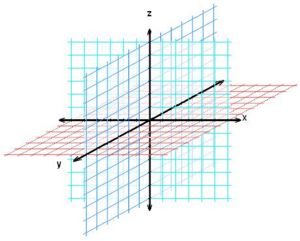
All of the Axes

For some reason, I was doubting myself on the plural of axis. I confirmed my recollection via googling that axes is the spelling of the plural of ax, axe, and axis, although the pronunciation of the plural is different.

Oddly enough, my topic is including each axis, of X, Y, and Z, still three items. My brain makes connections most others don’t, but I think of an axis of axes, AKA using an ax to represent an axis.  But that is a rabbit trail distracting from the intent of this post.

Yesterday, I wrote a review of +Jason Paul McCartan’s The Graveyard at Lus, for White Star. In that PDF, he briefly mentions position in space. While reading about the graveyard creation concept, I had an idea for determining the X, Y, and Z axis of a ship in a hex in space. I’m not sure what the three dimensional hexagon would look like. For example, a square in three dimensions is a cube. From this site I googled, it appears that a soccer ball or buckminsterfullerene is the closest thing.

Anyone who has watched Wrath of Khan will know why the Z axis is important.

My idea is to use 3d6, one for each of the X, Y, and Z axes. Ideally, a different colored die, or based on their position when they land.

The X axis is left to right, the Y axis is top to bottom, and we have two dimensions on a page or screen covered. The Z axis adds the bit that raises above or sinks below the page, or the things that appear to fly out at you in a 3-D movie.

If using dice of different colors, specify which is which before the roll. If using position, for example the one most to the left is X, most to the top is Y, and the remaining is Z, or designate the position to your liking. A third alternative is to roll one die three times, specifying which die is which axis, but that slows things way down.

Since we will be using 2-D maps on paper or screen, X will be running right to left on the page, Y will run top to bottom, and Z will rise above the page or sink below it.

Each die will use 1-2, 3-4, and 5-6 for 3 options for each. There’s no mechanic in this for dead center, but say if all three die come up 3 it means dead center. Or if they do come up all 3’s, roll a control die and if it comes up 3, or the designated number, it means dead center. That would be more for placement of a single item in a hex. This mechanic would work better for relative positions of one ship encountering another.

For the X axis:

  • 1-2 = to the left (For example 1 could be far left, 2 middle left.)
  • 3-4 = to the center (For example 3 could be left of center and 4 right of center.)
  • 5-6 = to the right (For example 5 could be middle right and 6 could be far right.)

For the Y axis:

  • 1-2 = to the top
  • 3-4 = to the center
  • 5-6 = to the bottom

For the Z axis:

  • 1-2 = higher in the hex
  • 3-4 = to the center
  • 5-6 = lower in the hex

The above only allows for rough approximations, and is probably good enough for a fast-paced game. Use another roll to determine distance, etc.

If more precision is wanted for more exact placement of an item in a space hex, determine the size of the hex and divide it into increments and pick an appropriate die to roll. For example, figure out how to divide the size of the hex by 100 and roll three percentile dice, i.e. 3d%, one for each axis. You may narrow a million cubic miles down to 10,000 cubic miles of space, and then repeat the process to narrow down to the 100 cubic miles, and once again, for where in that 100 cubic miles is the one cubic mile of space with the object in question. If the item is large enough, perhaps you don’t need to keep rolling, but what if it is a lost wedding ring? You’ll be rolling a long time. I think it would be good to just have the approximate location with the 3d6 method and just use roleplay and skill checks/challenge rolls to find the item.

The cool thing about the 3d6 for three axes positioning works for air travel/combat, and for elevation above or below ground, or above or below water, etc.

One could also take the teleport spell from AD&D and the percentage change to teleport high or low, but that does not allow for X and Y.

How would this work? Let’s take the example of two ships in White Star one with the players, the other a random encounter. Roll 3d6 for relative position of each, and determine approximate distance that each detects the other. The Graveyard at Lus has suggestions for how to handle distance with scanners. Generally, the GM’s will have an idea of what scale they are using, and will have an idea of what dice to use to determine distance.

There are a lot of variables for determining distance, including damaged scanners, cloaking devices, etc. I think rules for encounters and pursuit and evasion of pursuit have enough ideas to cover determining distance, so I won’t come up with something new at this point.

This is a bit of crunchiness in RPG’s that you can use as desired; meaning use it, modify it, or don’t use at all.

If this was helpful to you, please comment!

READ AN RPG BOOK IN PUBLIC WEEK – 2015 – July 26th – August 1st, 2015

Just a little reminder that next week starting this Sunday, July 26th through August 1st, is the second of the three annual weeks for Read an RPG Book in Public Week.

This year, I have not managed to read an RPG book in public during an official week, but I have read part of the 5th Edition Player’s Handbook while in my hammock, between two big trees in my front yard. If the weather cooperates, I should be able to manage to actually meet this challenge.


DungeonMorphs 2: Cities & Villages: Map Generator Dice/Cards by Inkwell Ideas – They’re Here!

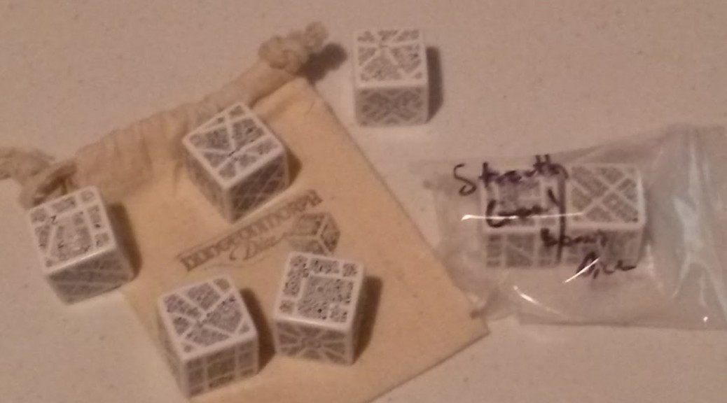
I backed this Kickstarter last year, and it was intended to ship by the end of May, and my dice set of five dice, plus two challenge goal bonus dice arrived today. I haven’t had a follow up post on this since this one in December. In addition to the dice, the five dice set has a small canvas dice bag, labeled Dungeonmorph Dice.

I knew this might be here today, after the update email on Saturday. I was glad to finally get it. My desire for them was to help give me ideas to flesh out a large ruined city. Aspects of my personal project keep dragging on and on due to real life, etc. I’m glad I finally have it,!

Now the outstanding Kickstarters I have backed are down to four:

  • Grimtooth’s Ultimate Traps Collection (The PDF is done and an update with bookmarks and clean up is nearly ready for us to review, before the book is printed. I order the hard cover.)
  • City State of the Invincible Overlord (I went for the book and the maps. I hope I get my stuff soon. The last update at the end of June indicated the first draft is done.
  • The Planet Mercenary RPG (I didn’t get the game, I got the book – “THE SEVENTY MAXIMS OF MAXIMALLY EFFECTIVE MERCENARIES”.)
  • Finally, the one I don’t expect anything to happen: The Great Kingdom, which was supposed to ship this month; before all the legal issues.

While I might back other Kickstarters, I’m not sure how many of them will be RPG related. Most likely, they will be nostalgia related, such as stuff from back in the day that I never had, or no longer have.


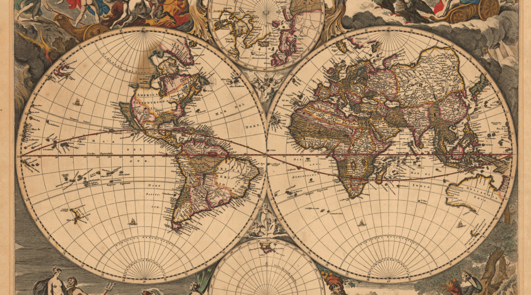
The Map Is Not The World

I posted a review about two different published books of hex paper the other day. I shared the post on the RPG Blog Alliance Community, and had this comment: “But then those hexes put an artificial constraint on mapping. First map, then grid.”
I started a reply, and it just got longer and longer, so I decided it made more sense to make a post out of it.
I’ve had the title for this post for several weeks, and was gong to write about it anyway, this just seems to fit.
Each DM must do what works best for them, when it comes to mapping. If making a map and then adding hexes, squares, or whatever it is you use, works for you, great!

There are two kinds of maps – those for the player and those for the DM.

As DM I need the hexes as I plot where things are to gauge accurate distances, etc. I already have maps, the one drawn by my brother, the artist, after he saw my original map 25+ years ago, and was like, “Just, no….:. He drew it on hex paper. He chose not to see the hexes when he drew it.

The other(s) are a collection of maps I put together from zooming in, and I changed my interpretation of the original map. I goofed and need to get one consolidated map to fix stuff I was just dealing with mentally during play. That only works with the player’s in my in-person game. For my start up of an online version of the game with the same starting point as the original players, I need to fix it.

For players, I can draw it however I want, and scale and accuracy don’t matter. (Unless it’s a science fiction or modern setting where technology and accurate maps are easily available.) The players just need an idea of how things relate to each other.

For games, there are two styles of maps, accurate and properly scaled and artful maps. Some have the talent to do both at the same time on the same piece of paper/computer interface.

I don’t want to do the map in Hexographer, for example, and then give it to players, they can guess where the hexes are, and learn things before they encounter them.

My chicken scratches on hex paper is so that I know at a glance what is where. It is a tool for use in play. For hex crawl style play, this is needed. I have always played the hex crawl style, we just didn’t call it that back then. We just called it play.
The player’s won’t see this map.

My player’s will only have maps that are available to the people of my world. They also have to be able to find the maps, and try to get a peek, or beg, borrow, or steal them. I am thinking of maps in the style of ancient and medieval maps.

Maps of large scale with close to the accuracy of modern maps did not happen until accurate clocks allowed tracking and plotting position. If you have seen maps that exaggerate how big Florida is, you will get my point. It changed size drastically as more accurate measurement of time and distance occurred.

Such maps give one an impression of the world that can have interesting repercussions if you follow them literally.

Even modern maps, such as flat projections of the entire planet skew the size of Greenland, and other places, to a ridiculous degree. One has to use a very creative representation on a flat surface to get size, coastline, and distances accurate. The best way to represent a planet is with a globe. Even then, the kind with relief that indicates mountains and valleys does not have an accurate representation. I have heard people say, and read it somewhere, that if the Earth were the size of a bowling ball it would be smoother than a bowling ball. Also a bowling ball scaled up to the size of Earth would have ridiculously high mountains and deep valleys.

No matter how we try to map, we don’t have a way, that I know of, to allow a person to see a representation of the whole planet, that is accurate in all aspects and allows one to see the entire surface as with a flat map.

Unless our fantasy world is flat, we can’t make an accurate map.

We have two choices, spend a lot of time doing the math and adjustments necessary to account for distances as one moves North or South, or just fudge it.

I tend to be a detail oriented guy, but the level of calculation needed to do that and make it perfect takes a lot of time that I could be putting into more maps or other game preparation.

Even a science fiction or modern setting for an RPG with accurate map making technology and easily available copies, it is easier to hand wave certain things. If a planet hopping science fiction RPG, I won’t map every inch of a globe, if there is a known location the players are seeking. If they do a different planet for each adventure, I’m not mapping a planet and placing all the cities and towns, and then not using them again. I may not make a map to share with the players, but just have a description of the atmosphere, continents, climate zones, and tech level. If I couldn’t find an online generator, I would build a script(s) to quickly spit this out for me, or just roll like a madman, like it was back in the day.

Some people can spit out maps a lot quicker than I can. For me, it is a challenge to make them not all look alike, especially dungeons. I explain some sameness as a cultural thing of the builders. Does anyone design a dungeon and then add the grid? I don’t know of anyone back in the day who did it that way. We all grabbed the graph paper we could find, whether 4 or 5 hexes to the inch. My group favored 5 squares to the inch. I use both sizes now. My aging eyes have  a preference for the slightly larger 4 squares to the inch.

No matter what form of map we use to represent a solar system, planet, continent, country, city, village, dungeon, tomb, etc. It is not an accurate representation. Using the grid of squares or hexes to make an accurate plot, it only a two dimensional representation, height it missing. With no grid and whether hand drawn and scanned and further manipulated or drawn directly to computer via mouse or stylus and tablet, and made into a thing of beauty, neither is an accurate representation. Each only gives some of the information that is further conveyed by our descriptions of what our players see.

With theater of the mind, we can use a few apt descriptions and make those of us with less than fantastic map skills allow each player to construct the world in their own mind.

If we could generate directly from the mind what each of us “sees” for a certain world, I suspect that there would be very few parts of them match up exactly.

There is also another aspect to mapping. Use at the table for one’s own group, and publishing a product, be it a module, or a setting. For just a playable item, I can easily do it myself. For a map in a published product, I would either spend the time to get really good at making maps, or I would hire someone to do it.

The audience for the map tells a lot about the requirements for the map. I can have a few scribbles on paper, and I can run a game. If I want to take that idea and attempt to market it, I have to put a LOT more into it.

For me to take my world, or one of the adventures of my players, and make a publishable product out of it that stands a chance of selling, will take a lot of development to make happen. The few notes one can use to DM with quickly grows if one starts writing out what must be known to let someone else DM the same scenario. Even all that extra work to let others into my world, in  whole, or in part, cannot begin to capture the way I see it in my mind. There was an infamous Kickstarter for a megadungeon that, from what I have read online, illustrates this point. What works for the creator to run his creation, is often insufficient for another to pick up and do the same.

Hex Paper For Mapping

Finding a good and affordable source for hex paper for mapping is a challenge. I am old school because I still have a few of the TSR hex paper sheets that I won’t use, because I can’t easily get more. One package served my brother, Robert and I well for many years, but I need more to do the kind of mapping I want to do.

I can scan the folded sheets and print out, or go to a copy store and make more expensive copies.

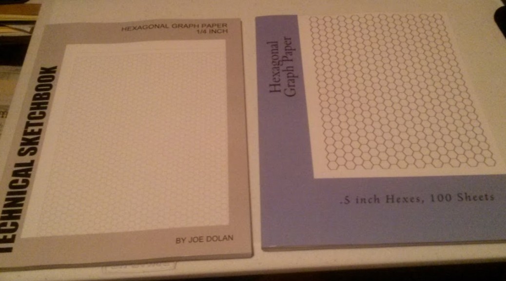
To add to my collection of pads of graph paper, I ordered two softcover books of hex paper, one with .5 inch hexes, and the other with .25 inch hexes.

Hexagonal Graph Paper
Hexagonal Graph Paper – What a crappy picture? I should fire my photographer…. Oh, wait, that’s me.

The .5 inch hexes are a book called Hexagonal Graph Paper, by Paul Fleury, c. 2014. It has 100 pages, i.e. 50 double-sided sheets. There is an approximate half inch border all the way around. The lines are dark/bold black. This makes them show up well, and they would be clear if a map were colored with colored pencils, and perhaps felt tip pens. The printing on both sides of the page are lined up, so there is no offset hexes when held up to the light.

The one drawback is that the pages are not perforated. Separating the sheets risks tearing the part of the page you want to keep. You could get an X-acto knife to cut out each sheet, or cut off the edge with the glue and separate all the pages. However, that would defeat the handy package of having it all in a book.

Since the hexes are such dark lines, I don’t know how easy it would be to clean them up/remove them if a map was scanned for use online.

Technical Sketchbook

The other book of hex paper is Technical Sketchbook: Hexagonal Graph Paper 1/4 Inch by Joe Dolan, c. 2010. It does not say how many pages, but I guess it is 100 since it is the same thickness of the other book I did buy this knowing from Amazon reviews that there is an imperfection on every page on the right side of the page. One hex has a stray diagonal line in it. Due to the lightness of the ink, it is hard to catch at a glance, but is easy to find if you look for it.

The ink is more of a light gray, so heavy coloring could obscure the hexes. Scanning might not pick up the hexes. There is about a half inch of border along the top and bottom, but the sides is about a quarter inch. The margin on the right side widens, and the one on the left side narrows as you advance through the book. Unlike the other book of half inch hexes, this one has a border around the hexes that “cuts off” the hexes on the edge. There is also a line across the top of each page. I suppose it is there for a place to write a title for each page.

Just like the other book, the pages are not perforated. The shrinking inside margin makes removal even more tricky than the other. The hexes are “jagged”. That is, the lines look somewhat like they were printed with a dot matrix printer. These stippled lines are rough/pixelated on the diagonals of the hexes. Scanning would exacerbate this, for the parts of the lines it might pick up.

From just looking at the sheets in each book, I think they will be fine for drawing maps. If the idea is to use maps at the table, they will get fingerprints, oil and sweat from fingers, drips and spills from drinks, crumbs from food, etc. If you are looking for fancy paper to do award winning art, these are probably not for you. If you are looking for a not too expensive source for hex paper for making maps that you will use, these will do.

From my experience with hex map making from back in the day, the 1/4 inch hexes are good for the general idea of what is in an area on a large scale map. The 1/2 inch hexes are good for the greater detail when zoomed into the local area, for 5 or 6 mile hexes, or perhaps smaller.

Once I start making some maps with them, I will scan some samples and post in a future article.

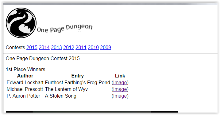
2015 One Page Dungeon Contest – Winners Announced

The winners of the 2015 One Page Dungeon Contest were announced a few days ago. Check out the 1PDC Google Community.

My entry, The Dire Druids of Delver’s Deep, was not among them. I did not expect to win. I knew that there were many who had massively better entries in look, layout, and more from prior years. My entry was an exercise to see what I could do with an idea.

From what I have seen of the winners of the last couple of years, one needs an idea that is solid and well defined with a great hook. The Artwork needs to be top notch, and the layout has to make it all “flow” and draw the reader into it.

I am curious to watch the recording of the Google Hangout with the judges [Link Broken, no alternative, August, 2017], to see if there are any “simple” dungeons that had ideas they liked, but due to art or layout, did not make the cut. Set aside about 45 minutes if you want to watch it all in one go. I missed the live hangout.

Out of all the submissions, there were 3 first place winners, 6 second place winners, 13 third place winners, and 5 honorable mentions. Based purely on first names in each category, it looks like there is one women in each of the last three categories. This makes 97 new dungeons. Since 2009, seven years, that’s about 700 dungeons. Not all are fantasy, not all are dungeons. Still, that is a lot of ideas if your creative well has ran dry. I like to grab and re-purpose the maps for my own use.

One blogger, +Aaron Frost,  of Wasted The Game, is going through all the 1PDC entries and giving his thoughts on them. He has a lot of material.

Daddy Rolled A 1 was a judge last year and again this year. Here is his take on the process.

After watching the hangout video there are a few things one can take away about how to approach this contest.

  • The Past and Storytelling are not as important.
    • What is going on NOW?
    • What situation will the characters encounter when you run it?
  • Brief yet Complete.
  • Set up well in the beginning with an answer to how does it end/get resolved?
  • White space/Imagery/Readable
  • The art is not as important as an idea that is presented well.
  • Spelling and Grammar – i.e. after you spellcheck and grammar check it, get a proofreader.
  • Put enough time into it to do it well.

I know that I had a lot of text. Paring that down to something that “pops” would improve it. That is, express the intent without requiring too much detail.

The hangout mentioned one winning submission that had excellent 2 sentence NPC descriptions that made for NPCs that could be plugged into any campaign.

I would suggest reading through the submissions and learning from them. What did the winners do well? What did the others not do as well that might best be avoided?

One more shout out, +Random Wizard [UPDATE: Random Wizard is no longer on G+. Check out his blog: https://www.kirith.com/random-wizard/] has sold off unused items in his personal collection to ensure that there are prizes for all 13 of the third place winners, a $25 store credit at Wayne’s Books! Talk about a class act! Not only has he given his time to organize the contest, he made sure that third place had prizes out of his own pocket!

There will always be grumblers who complain about things, and complaining is their ONLY “contribution.” It is easy to say that this or that wasn’t right, fair, or the way you would do it. If you are not willing to step up and add something of value to the hobby, why are you tearing down others who are? I don’t know who these complainers are about the 1PDC, they must be ranting on some forum to which I don’t belong. Of that, I am glad. I only know about it, because I saw mention of it on another blog. If the complainers would put forth the energy they spend complaining into making something to share with the others in the OSR, we’d all be better for it. It reminds me of my sons when they complained about doing homework or cleaning their room. If they would have shut up and just done the task at hand, it would have required less energy. Oh well, it is the loss of the complainers. Once we learn what an internet troll is, we know to ignore it, and it becomes as static. It is annoying, but we can learn to tune it out.

I for one am interested to read through the entries. I also am interested in attempting a submission for next year. I may come up with an idea and start working it out to boil it down to the good stuff. Better yet, I’ll take more time on the layout and presentation.

Review – Rob Kuntz’s Dark Druids

Rob Kuntz’s Dark Druids was on sale a few weeks back. It arrived at the end of April. Since my submission to the 2015 One Page Dungeon Contest involved druids – The Dire Druids of Delver’s Deep, I waited until after I completed my submission to read this module. My planned postings got sidetracked, since I jumped on board the White Star bandwagon.

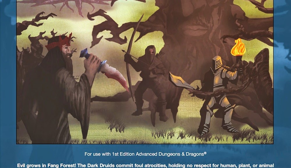
This module clearly states on the cover below the illustration: “For use with 1st Edition Advanced Dungeons & Dragons(R)”. Unlike others, it is not afraid to say this and also acknowledges that the name of the game is a registered trademark. It is one of three modules currently available from Chaotic Henchmen Productions.

The blurb from the back cover explains what this module is all about: “Dark Druids includes complete descriptions and maps for an outdoor area and a three-level adventure site, and is easily adaptable to most campaign settings. It also includes an outline for further adventuring, a selection of new monsters, spells, and magic items, plus Robert J. Kuntz’s historical context and commentary on this module’s relationship to his campaigns of the 1970’s”

This module is designed for levels 8-12, so it is not a low power adventure. It has the general look and feel of a module from back in the day. The cover can serve as a screen and includes the 1st and  3rd level of the dungeon. The 2nd level is on the last page of the module. This 56 page module has more maps for the outdoors area and illustrations to compliment the text.

After a forward and author preface, there is a section on Using the Module that discusses party composition and challenges, preparations before play, and how to read and interpret the module text. There is a player introduction, which is a lot of text to read. Lastly there is a half page of rewards and additional party resources.

After a page for the GM introduction, there are just over three and a half pages with the outdoor map, starting text, and key to the outdoor map.

The dungeon’s three levels are detailed on pages 9 through 35.

There are seven appendices, A through F.

A – Deals with further adventuring against the drak druids.

B – Is an article about a Dark God.

C – Discusses changes in this version of the module from the 2006 version published by Creations Unlimited.

D – Lists the 16 new magic items in this module.

E – Details four new monsters.

F – Describes the dark druid variant class.

The module was well sealed in cardboard and bubble wrap and sealed with scotch tape in a clear plastic magazine sleeve.

I like the look and feel of this. The maps are well done and easy to read. The text itself is laid out well and easy to read. However, the “Read-aloud text” is in italics. For some rooms this text is the first part of that room’s description, but for others it is later. Thankfully, while not like some italics fonts that I sometimes have trouble distinguishing from the normal font, there is nothing else to set it apart. When actually running this, it would be very easy to miss a key detail. If I were to run this module as written, I would have to use different colored highlighters and ink to note the important parts. I find this to be more of a concern as my eyes age.

When not in a live game situation and no pressure, it is definitely easy to read. There is a lot of information here, it is dense.

It is something that would require a lot of streamlining to run in a con setting. In a con setting it is bigger than can be handled in the average 3 or 4 hour session. There is enough in here, that it would take one massive marathon session to complete the entire module in one go. I can see this easily taking many sessions depending on the focus of the players, and the decisions and rolls they make.

One can easily place this on a list of possibilities, when players get to that level, and fit it into the campaign. AD&D is not that much different from OD&D and modern clones, that this could easily be used in nearly any OSR game. There is a lot in here, that it will take more than a casual reading to catch all that is in here. This could easily be part of a behind the scenes activity that builds up to this module, or it could be a new stand-alone threat. Because this is so dense, I have not managed to read the whole thing carefully, but I like what I see.

This is an interesting concept and ties in with my articles on druids.

Calculating Size of an Irregular Area in a Graphics Program

Interesting idea – use the features of your graphics program to calculate the area of an irregular shape to get an accurate count of its size to calculate the number of people it can support.

Over at Lost Kingdom, they have an article on Surface area of an irregular shape in Photoshop. There is a helpful comment at the end of another way to do it by determining the number of pixels and determining how much area a single pixel equals. I don’t have Photoshop, but use Gimp and Inkscape. The question is posed in the article asking if Gimp can do this. I am far from a strong user of either program. I manage to get what I need out of them.

That is a very refined calculation, and perhaps more than most would worry about, but if precision is needed or desired, this is an interesting way to do it. I recall from college calculus that there is a way to calculate this but I have no recollections of the specifics of how to do it. There has only been one instance in my life that I wished I could remember how to figure something using Algebra, but it was quicker for me to figure it out the hard way than figure out how to apply the formula. I first took algebra about 35 years ago. I usually get by with basic arithmetic.

Geographical Descriptions

There are tons of types of geographical features. I ran across a link that uses pictures to group geographical descriptions, but it uses pictures, so there is no easy cut & paste of the text. I have typed up all the descriptions used and put them at the end of this article.

Still, I find Useful Geographical Descriptions For Writers helpful. I saved all the pictures to my computer, in case this link goes dead. I’m a bit of a writer, I have a nearly done first draft of a novel, and DM’s/GM’s are always looking for things to spice up their descriptions. There are some pretty crazy geographical types, like different types of lakes or caves.

When building your world, some fantastic ideas just might be fueled by reality.

Meadows and Grasslands

Steppe – extensive area of treeless grassland with short grasses and less rainfall than a prairie

veld, veldt – steppe with scattered trees and shrubs (especially in Africa

tundra – extensive northern (arctic) treeless plain with mucky soil

sward – green tract of grassland or turf

lea, mead – grassland for grazing or hay

fell – high moor or barren field

moor, moorland – a tract of open, peaty, wasteland, often overgrown with heath, common in high latitudes and altitudes where drainage is poor

barrens – scruby, uncultivated ground, or land along a lagoon covered by high water

heath – an area of open uncultivated land, esp. in Britain, with characteristic vegetation of heather, gorse, and coarse grasses

croft – yard or field used as a household kitchen garden or for a few farm animals

paddock – a small field or enclosure where horses are kept or exercised

boondocks – an uninhabited area with thick natural vegetation, as a backwoods or marsh

Hill, Mountains, and Valleys

knoll, hillock, barrow (British) – small and rounded hill

downs – rolling grassy upland with few trees

plateau – extensive flat-topped land elevation that rises steeply on at least one side

mesa, butte – isolated steep hill or small mountain

pike, peak, summit – top of a mountain

glacial horn, horn of the mountain, pyramidal peak – an angular, sharply-pointed mountain peak which results from the cirque erosion due to multiple glaciers diverging from a central point

aerie, eyrie – elevated place

palisade, palisades – cliff formation or line of cliffs

dell, glen – small and nestled (usually wooded) valley

hollow, combe – deep and narrow valley

vale, dale – valley

scree – rocky debris on a mountain slope

fumarole – volcanic vapor hole

maar – Extinct volcano crater often containing a lake or marsh

Trees and Bushes

bower, bowery – leafy tree-enclosed nook or recess (also the nest of a bowerbird)

arbor – a leafy, shady recess formed by tree branches, usually manmade

grove – small group of grouping of trees (usually without undergrowth

weald – wooded or uncultivated country

timberland – land covered with timber-producing forests

thicket – cluster of shrubs or small trees

bosk (adj. bosky) – a small wood or thicket, especially of bushes

copse, grove – grove or thicket of small trees

coppice – a thicket or dense growth of small trees or bushes, esp. one regularly trimmed back to stumps so that a continual supply of small poles and firewood is obtained; copse

underbrush, undergrowth – shrubs, saplings, low vines, etc., growing under the large trees in a wood or forest

canebrake – thicket of cane

deciduous – describing a tree or forest with foliage that falls off annually

bough – a branch of a tree, especially of the larger or main branches

hinterland – the remote parts of a country, or back country

Deserts and Miscellaneous

sand dunes, dunes – a mound or ridge of sand or other loose sediment formed by the wind, esp. on the sea coast of in a desert

playa – an area of flat, dried-up land, esp. a desert basin from which water evaporates quickly

arroyo – a dry desert gully

hogback – an eroded, steeply tilted ridge of resistant rocks with equal slopes on the sides

hoodoo – a column or pillar of bizarre shape caused by differential erosion on rocks of different hardness

chaparral – vegetation consisting chiefly of tangled shrubs and thorny bushes

karst – landscape underlain by limestone that has been eroded by dissolution, producing ridges, towers, fissures, sinkholes, and other characteristic land forms

salt flats, salt pans – flat expanses of ground covered with salt and other minerals, usually shining white under the sun

oasis, watering hole, spring – a fertile spot in a desert where water is found

seep – a place where petroleum or water oozes slowly out of the ground

tar pit – a hollow in which natural tar [asphalt] accumulates by seepage

Rivers, Oceans, and Wetlands

Watersmeet – junction of two rivers

headwaters – river’s upper tributaries

ford – shallow area of water that can be waded across

levee – a ridge of sediment deposited naturally alongside o river by overflowing water, or an embankment built to prevent the overflow of a river

delta – river mouth’s often fan-shaped sedimentary plain

estuary, frith – sea’s juncture with a river’s mouth

strait – connecting passage between two large bodies of water

riverain – pertaining to or like a riverbank

sandspit – small jutting of sand or gravel at water’s edge

lagoon – shallow pond near a body of water

tarn – small mountain lake with steep banks

millpond – a pond for supplying water to drive a mill wheel

loch – a lake or partially landlocked or protected bay

mere – (British) a lake or pond

sluice, sluiceway – an artificial channel for conducting water, often fitted with a gate (sluice gate) at the upper end for regulating the flow

narrows, straits, channel – a narrow channel connecting two larger areas of water

gulf – extensive sea inlet

fjord – sea inlet that is narrow and has steep sides or cliffs

cay, key – low coral island or visible reef

atoll – ring-like coral island or reef surrounding a lagoon

shingle – pebbled or stony beach

shoal – shallow place in a sea or river

eddy – small whirlpool

bog, fen – tract of low and wet spongy ground

tideland – low land subject to flood tides

tide flat – flat and usually muddy tideland

bracken – rough or marshy tract of land with one kind of vegetation (shrubs or ferns)

swale – moist low-lying land (usually pineland)

causeway – raised path or road across water or a marsh

cape – land formation jutting into the sea or other large body of water

headland,promontory – elevated land area juttying over the sea or other large body of water

floe – sheet of floating ice

hoarfrost, hoar – frost (Middle-English)

rime, rime ice – an opaque coating of tiny, white, granular ice particles most commonly seen on tree branches

snowdrift, snowbank – a mound or bank of snow driven together by the wind

permafrost – (in arctic or subarctic regions) perennially frozen subsoil

sleet – ice pellets created by the freezing of rain as it falls (distinguished from hail)

Caves, Cliffs, and Rocks

grotto, cavern, hollow – underground or rock-walled chamber

stalactite, dripstone – icicle-like formation hanging in a cave

stalagmite – icicle-like formation on the floor of a cave

flowstone – rock deposited as a thin sheet by precipitation from flowing water

bluff, precipice – a cliff, headland, or hill with a broad, steep face

crag – a steep, rugged rock; rough, broken, projecting part of a rock

scarp – a line of cliffs formed by the faulting or fracturing of the earth’s crust; an escarpment

rocky outcrop – part of a rock formation or mineral vein that appears at the surface of the earth

bedrock – unbroken solid rock, overlaid in most places by soil or rock fragments

rubble – broken bits and pieces of rock, through demolition, quarry, or natural processes

scree – a steep mass of detritus (or rubble) on the side of a mountain

slag – coal waste or waste obtained from smelting ore

gulch, gully – a deep narrow ravine, a ditch or gutter

gorge – a narrow cleft with steep, rocky walls, especially one through which a stream runs.

crevasse – a fissure or deep cleft in the earth’s surface.

stack – a steep and often vertical column or columns of rock in the sear near a coast, formed by erosion

stone run – rock landform resulting from the erosion of particular rock varieties caused by myriad freezing-thawing cycles

inselberg, monadnock, kopje (Dutch), bornhardt – an isolated rock hill, knob, ridge, or small mountain that rises abruptly from a gently sloping or virtually level surrounding plain

promontory, headland (over water) – prominent mass of land that overlooks lower-lying land or a body of water

cenote – a natural pit, or sinkhole resulting from the collapse of limestone bedrock that exposes groundwater underneath

tor – a large, free-standing residual mass (rocky outcrop) that rises abruptly from the surrounding smooth and gentle slopes of a rounded hill summit or ridge crest